
The weekend of April 6 and 7 was particularly warm in France for April. Several monthly temperature records were set locally on April 6, 2024. The day was also the hottest ever recorded before April 15 in the country, according to the Infoclimat association.
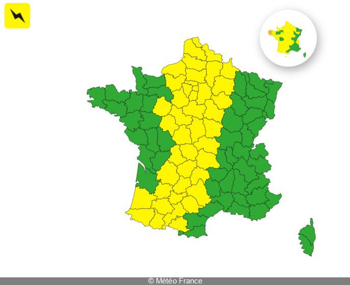
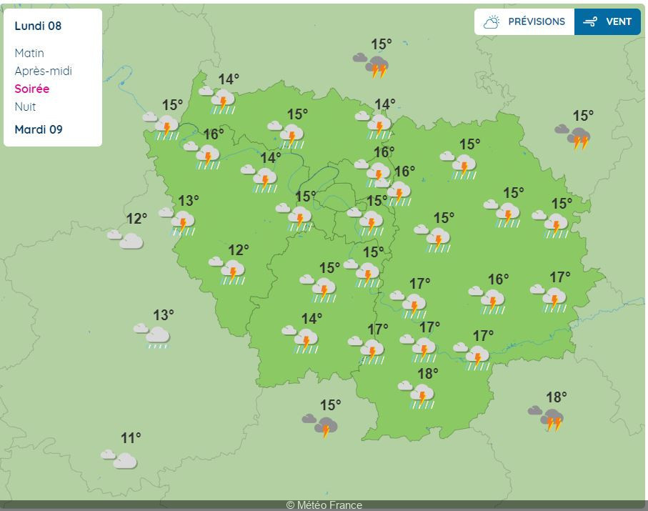
On Monday April 8, 2024, the weather changes with the arrival of the low-pressure system 'Pierrick' in France. "The low-pressure system named 'Pierrick' enters the English Channel near northern Finistère early Monday afternoon, then moves along the south coast of England, generating strong winds and a risk of wave-submergence," warns Météo France in today's bulletin. For Monday, Météo France has placed 45 French departments under yellow "thunderstorm" alert. These include Nord, Ariège, Dordogne, Aveyron, Sarthe, Ardennes, Seine-Maritime, Aisne, Eure and Oise.
What's the situation in the Paris region? Will thunder rumble in Paris and the Ile-de-France region this Monday? If Météo France's forecasts are to be believed, it's likely. In the Île-de-France region, all departments are affected by this yellow alert for thunderstorms. Paris, Hauts-de-Seine, Seine-Saint-Denis, Val-de-Marne, Yvelines,Essonne, Seine-et-Marne and Val-d'Oise are being warned to be vigilant, due to the risk of severe thunderstorms forecast for Monday.
According to Météo France, these thunderstorms could hit the 8 departments of the Île-de-France region from 4pm onwards, and continue throughout the day and evening until around 11:30pm.
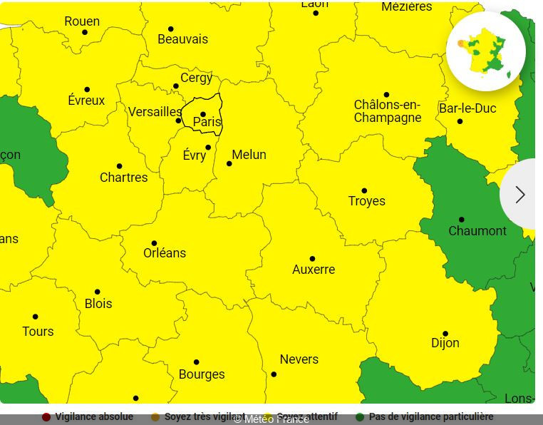
In addition, Paris and its inner suburbs, as well as Yvelines and Val-d'Oise, remain under yellow flood alert.
During these periods of inclement weather, Météo France advises you to watch out for thunderstorms, which are synonymous with danger. Here are a few recommendations to follow as a precaution