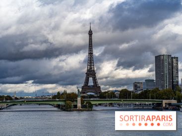
Did you imagine you'd be basking in the glow of the holiday? You'll have to wait a little longer. Météo France has placed 19 départements, including all of theIle-de-France region, under orange alert this Wednesday, due to the risk of potentially violent thunderstorms, which could sweep the country from Burgundy to the Haut-de-France region.
Météo-France has placed Paris and the surrounding area under orange alert this Wednesday, in anticipation of intense thunderstorm activity from 7pm. The particularity of these storms, according to the Météo-France bulletin issued this morning, lies in their virulence. Forecasters expect"heavy precipitation, hail and gusts". Electrical activity is also expected to be marked.
In addition to the orange alert for thunderstorms, a yellow alert for rain and flooding has also been issued. Although forecasts indicate intense rainfall, with values of up to "15 to 20 mm in 1 hour, and 30 to 40 mm, or even locally 50 mm in 3 to 4 hours", Météo-France stresses that the exact location and intensity of the heaviest accumulations are still uncertain.
Île-de-France must therefore prepare for strong gusts, which could reach 60 to 70 km/h, and occasionally as high as 80 or 90 km/h. The meteorological agency does not rule out the possibility of"whirlwind phenomena" in certain areas, adding a further element of uncertainty to the already tense situation.
This Thursday, orange vigilance is still in force in 17 départements, including Ile-de-France.
Residents and visitors to the region are advised to remain vigilant, follow updates from Météo-France and take the necessary precautions to protect themselves from these severe weather conditions.
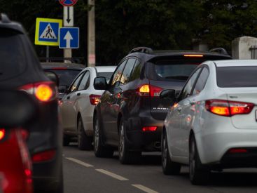
Traffic could become particularly tricky under the storms, with risks of urban runoff and flooding on frequently-affected roads and motorways. Rainfall of up to 20 to 30 mm per hour could occur under the most intense thunderstorm cells.
In addition to flooding, hail is also a serious threat, especially in the east of the region, in Seine-et-Marne, in the early evening. Gusts in excess of 80 km/h are also possible.
It's advisable to get home before 6pm-9pm to avoid being on the roads during the worst of the storms. Taking precautions is essential to avoid potentially dangerous situations during this normally festive holiday.
This Labor Day promises to be a turbulent and electric one, with serious mobility and safety challenges for Parisians. It's best to stay informed of weather updates and plan your travel accordingly to avoid the impact of this intense storm activity.
During this period of bad weather, Météo France advises you to watch out for thunderstorms, which are synonymous with danger. Here are a few recommendations to follow as a precaution:
Dates and Opening Time
From April 30th, 2024 to May 1st, 2024
Official website
meteofrance.com