While 19 départements were placed under orange heatwave vigilance on Friday August 18, the list is set to grow over the next few days. Météo France is announcing the arrival of an " episode of extreme heat gradually spreading across the country ". " This weekend, the hot weather will become more intense, particularly in the southern half of the country. They are likely to be long-lasting and intense, with values sometimes in excess of 40°C in the southeast from Sunday onwards. They are likely to continue until at least the middle of next week. The heatwave watch will therefore continue to evolve," says the weather service, adding that, on a national scale, " this new episode looks set to be the hottest of the summer of 2023, and also one of the latest with such a high level of intensity ".
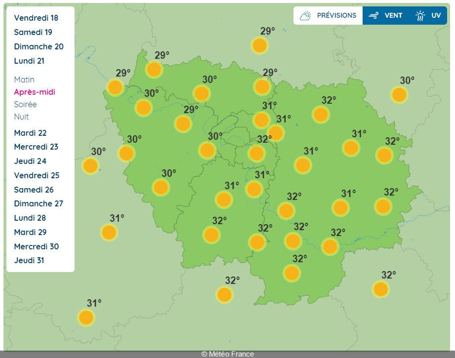
But what about the weather forecast for Paris and the Ile-de-France region? For the time being, the Ile-de-France region has not been placed on heatwave alert, while Savoie, Isère and Rhône have been placed on orange vigilance. However, the situation is likely to change, as temperatures could reach 32°C for three consecutive days on Monday August 21, Tuesday August 22 and Wednesday August 23. Overnight, from Tuesday to Wednesday and Wednesday to Thursday, the mercury is unlikely to drop below 21°C, or even 23°C in the heart of Paris.
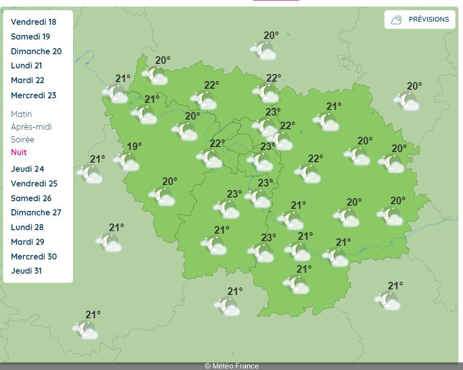
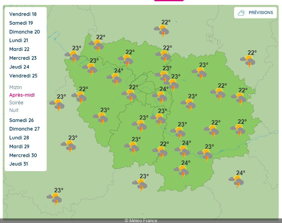
Still according to Météo France, the weather could turn stormy from Thursday August 24, when thundery showers could affect the Seine-et-Marne département by morning. On Friday August 25, thunderstorms are likely to affect the whole of the Ile-de-France region throughout the day. The same forecast applies to Saturday, August 26, when the mercury should return to a much more pleasant level, with daytime temperatures hovering between 21°C and 23°C.
Of course, this trend remains to be confirmed over the coming days, particularly as regards the risk of thunderstorms, which we'll be keeping a close eye on.
Official website
meteofrance.com