Paris and the Île-de-France region remain under yellow alert for rain, flooding, and river rises this Wednesday, February 18, 2026, according to Météo-France. After over a week of persistent rainfall, the Seine continues to rise, and there’s still a risk of snow falling over the capital later today. Here's the latest on a weather situation that shows no signs of letting up.
In total, 25 departments are currently on yellow rain and flood alert issued by Météo-France for today. Among them are Paris (75), Yvelines (78), Seine-et-Marne (77), Essonne (91), Hauts-de-Seine (92), Seine-Saint-Denis (93), Val-de-Marne (94), and Val-d'Oise (95). In other words, all eight Île-de-France departments are affected. A first wave of rain swept through the region overnight from Tuesday to Wednesday, and a second system is expected later today along the Atlantic coast, with accumulations reaching 30 to 50 mm over the duration of the event, and locally up to 60 mm.
Alongside the rain, 19 departments have been placed under a yellow alert for snow and ice this Wednesday. Among them, two Île-de-France departments are directly affected: Seine-et-Marne (77) and Val-d'Oise (95). They are joined in this alert by Aisne, Meuse, Pas-de-Calais, Bas-Rhin, Haut-Rhin, Seine-Maritime, Ardennes, Eure, Oise, Vosges, Marne, Haute-Marne, Moselle, Haute-Saône, Somme, Meurthe-et-Moselle, and the Territoire de Belfort.
According to Météo-France, light snow is falling at low altitudes this morning across Haute-Normandie and southern Hauts-de-France, extending into the Grand-Est region, with 2 to 3 cm expected and localized up to 5 cm on higher ground. In Île-de-France, Meteo-Paris.com reports occasional rain mixed with snow in Essonne during the morning, before temperatures rise again in the evening. This event is less intense than last Sunday’s when Île-de-France was under an orange alert for snow and ice, with 1 to 5 cm on the ground, but caution remains advised, especially on the roads in the outer suburbs.
On the Seine River flood front, the situation remains tense. The river’s water level reached 3.52 meters Tuesday morning at the Paris-Austerlitz measurement point, having surpassed the 3.20-meter threshold on Sunday evening. This automatically triggers the closure of the quays in the capital. The Georges Pompidou road is closed between the Tuileries and Henri IV tunnels, as well as between the Garigliano Bridge and Bir-Hakeim. Pedestrian walkways along the Seine Riverside Parks, on both the right and left banks, are also inaccessible. Many quays and ports are shut in the 1st, 4th, 12th, 13th, and 16th districts. The evolution of the Seine’s level is monitored in real-time on Vigicrues. While this flood event is considered typical for the season by the City of Paris, upcoming rainfall expected this Wednesday is unlikely to help and may even delay the receding waters.
Nationwide, the situation remains critical. The Gironde, Lot-et-Garonne, and Maine-et-Loire are still on red flood alert, while Charente-Maritime joined them this Wednesday. The Finistère and Morbihan regions have been upgraded to orange rain-flood alert, with heavy rainfall expected on already saturated soils. This flood crisis has been affecting a large part of western France for weeks, with roads closed, buildings evacuated, and thousands of households without power.
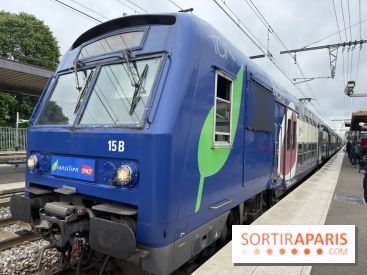
Temperatures in Île-de-France are expected to range between 6°C and 9°C this Wednesday, according to Franceinfo météo. Naturally, attention is focused on transportation, which could be disrupted by the ongoing adverse weather conditions. Travelers are advised to check Île-de-France Mobilités for real-time traffic updates. For drivers, the closure of the quayside lanes is causing major traffic jams during peak hours, and the risk of snow in the outer suburbs could further complicate travel, especially early in the morning. Overall, Wednesday, February 18, 2026, continues a particularly unpredictable February in Île-de-France, marked by storms, floods, snow, and persistent rainfall. The good news is that a warm-up is forecasted starting this weekend, with temperatures climbing back to around 11 to 13°C and calmer weather. In the meantime, don’t forget your umbrella and waterproof boots!