
This Tuesday, March 11, 2025, Météo France has placed 69 départements under yellow alert due to various weather risks. In the Ile-de-France region,Essonne is affected by thunderstorms. The alert, which has been in force since 3 p.m., is due to end around 8 p.m. Forecasts predict a lull on Wednesday, accompanied by a drop in temperatures.
Essonne will be particularly affected by thunderstorms, with more pronounced activity in the southeast of the département, according to Météo France. Temperatures will hover between 10 and 12°C in the afternoon. The following night should see a lull, with a few showers and temperatures between 4 and 5°C.
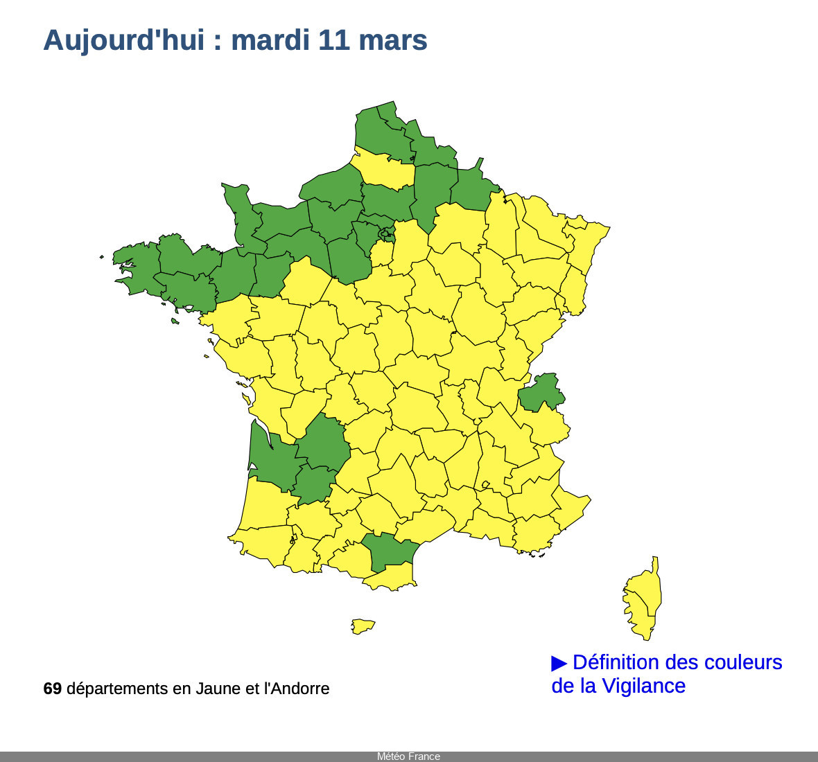
This phenomenon is not confined to Essonne. A large part of France has been placed on yellow alert, with 69 departments affected by various meteorological hazards. Of these, thunderstorms are the main cause for alert, affecting more than 60 departments.
In addition to thunderstorms, Météo France has also issued warnings for three other meteorological hazards: rain, flooding and avalanches. Most of the country is affected, with the exception of a strip stretching from Finistère to the Ardennes, as well as a few isolated departments such as Gironde, Dordogne, Lot-et-Garonne, Aude and Haute-Savoie.
After this stormy spell, the weather looks set to be calmer on Wednesday March 12. Skies will remain cloudy and temperatures will drop: 5°C in the morning and up to 9°C in the afternoon. A calmer day ahead for residents of Essonne and the other départements concerned.
In the event of astorm, it's essential to adopt the right reflexes to ensure your safety. Here is a list of the main recommendations to follow to avoid any danger: