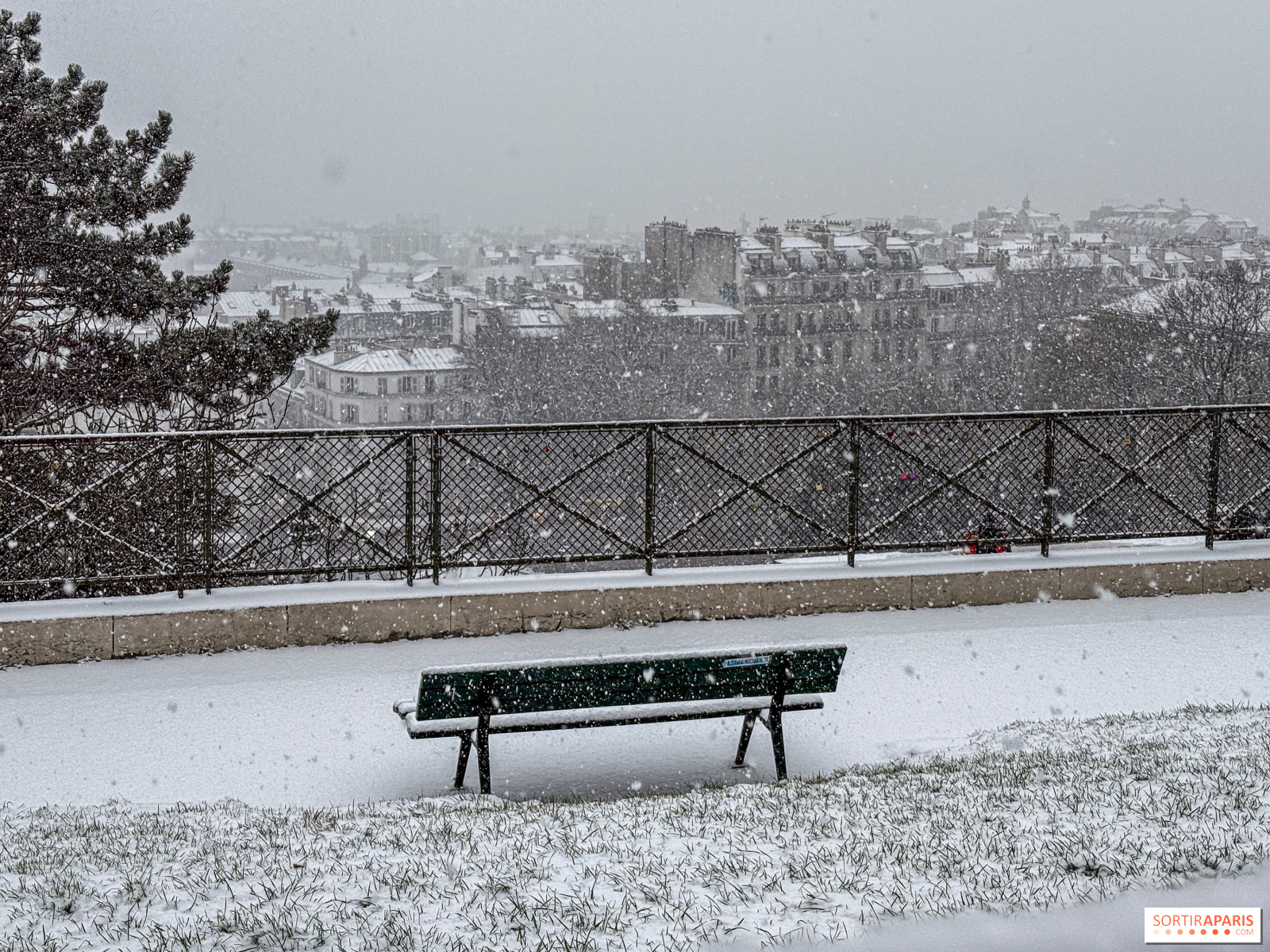
Following the heavy snowfall that affected the entire Île-de-France on Monday, more large snowflakes could fall once again across the Paris region this Wednesday, January 7, 2026.
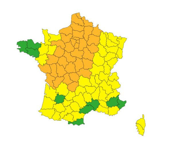
Due to the arrival of a new winter weather system and dropping temperatures, Météo France has issued a yellow alert for snow and ice across 38 departments in mainland France for January 7th. The affected areas include the northern and central regions, such as Pas-de-Calais, the Somme, Seine-Maritime, Orne, Sarthe, Oise, Loiret, Cher, as well as Vendée, Charente-Maritime, and the Ardennes.
A weather disturbance is set to move in across the English Channel late Tuesday night into Wednesday morning, then track across the northern half of the country on Wednesday. This will bring snow to large areas under orange alert, along with freezing rain or icy conditions on the ground in Poitou-Charentes and the western Pays de la Loire, warns Météo France in its latest forecast.
So, what should residents expect exactly in Paris and the rest of Île-de-France? The entire Île-de-France region is once again on alert this orange warning for snow and icy conditions this Wednesday. "A new snowfall is approaching the region from the northwest. It will gradually shift eastward, reaching Seine-et-Marne later this morning," warns Météo France. They specify that "all precipitation will fall as snow that immediately settles on the ground" due to low temperatures estimated between -2°C and 1°C in the morning. While predicting the situation's evolution remains tricky, the weather service indicates that "hourly snowfall rates are generally around 1 cm/h, but can sometimes be more intense, reaching temporarily 2 to 3 cm/h."
According to Météo France, the heaviest snowfall is expected in the capital city as well as in the departments of Seine-et-Marne, Yvelines, Val-d'Oise, Essonne, Hauts-de-Seine, Val-de-Marne, and Seine-Saint-Denis. This is forecast for January 7 starting at 6 a.m.
This orange alert remains in effect until approximately 3 p.m. across all Île-de-France departments, except for Seine-et-Marne. In this department of 77, the warning is valid until Wednesday at 6 p.m. After that, the region will revert to a yellow orange alert for "snow and ice." Météo France forecasts total accumulations of about 3 to 5 cm throughout the event, with localized amounts of up to 7 cm, more likely in the outer suburbs.

Furthermore, the cold spell continues to grip much of the country. As a result, the entire Île-de-France region remains under a yellow alert for "Extreme Cold" on this Wednesday, January 7, 2026.
Uncertainty still lingers at this stage. It’s advisable to stay informed about the latest updates to these forecasts and to check the upcoming refreshes of the vigilance map. Additionally, exercise extreme caution when traveling and, if possible, avoid driving in areas where icy conditions and snowfall are forecasted.
More information:
What will the weather be like this week in Paris and Île-de-France, from March 30 to April 6, 2026?
The weather this week, from March 30 to April 6, 2026, in Paris and Île-de-France is shaping up to be cool and unsettled, with predominantly cloudy skies. Temperatures will swing from 2°C to 19°C depending on the day, with regular showers and a noticeable breeze at the start of the week. [Read more]
Official website
meteofrance.com


 What will the weather be like this week in Paris and Île-de-France, from March 30 to April 6, 2026?