For the past ten days, we've been closely monitoring weather models to track updates on snow and cold forecasts for snow and freezing temperatures in Paris and the Île-de-France region as we approach the end of January 2026. Enthusiasts of snowy landscapes will be pleased to hear that recent forecasts have taken a dramatic turn. The idea of a winter storm approaching is now largely dismissed in favor of a very moist oceanic flow that will dominate Paris and the greater Île-de-France area, according to Météo Paris.
For a long time, meteorologists forecasted that a persistent Scandinavian anticyclone would hold firm, potentially channeling continental cold air down into France. Such a setup could have led to a drop in temperatures and snowfall even in the plains, including across the eight Île-de-France departments. However, the latest models indicate that these high-pressure systems are weakening and shifting toward Greenland.
This development allows Atlantic low-pressure systems to extend towards the Mediterranean and the Balkans. Specifically, a depressional oceanic flow is set to dominate France towards the end of January, bringing weather conditions that are generally not conducive to cold spells or snowfall in the plains. While the coming days may remain somewhat cool in the northern and eastern border regions, this cold snap is expected to dissipate starting Tuesday, January 27, 2026.
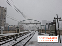
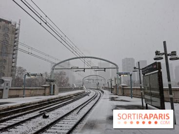
An active weather disturbance is expected to move across the country. As it reaches the northeastern regions, it might briefly bring some damp snow showers, but the latest forecasts are significantly reducing this possibility. In Paris and Île-de-France, the chances of snow are therefore becoming increasingly unlikely with each passing day.
While cold and snow may ultimately stay away, it's still important to stay alert to the weather conditions at the end of January 2026. Driven by a dominant Atlantic low-pressure system, a series of weather disturbances are expected to affect France, especially the Paris region. Forecasts for the week of January 26 to February 1 indicate a clear wet anomaly across the west and south of the country.
Heavy rainfall is expected, with precipitation totals reaching between 50 and 100 mm, and possibly more by the end of the month in many areas. While Île-de-France isn’t among the most affected regions, it’s wise to keep your umbrella handy in the coming days. The northern border areas, including our Île-de-France region, are forecasted to see slightly less heavy rainfall compared to the western and southern parts of the country.
With soil saturated in many regions—particularly in Brittany and around the Cévennes—each additional heavy rainstorm could lead to flooding and rising waters. It's crucial to stay updated daily on the evolving situation by checking Météo-France or Météo Paris.
Winter is far from over, and a resurgence of cold and snow in the lowlands could still happen during February—or even later in the season. Long-term weather forecasts remain unpredictable, as atmospheric patterns can shift rapidly.
To stay updated on the latest weather forecasts for Paris and Île-de-France, we recommend checking the official Météo-France reports regularly. For more localized and detailed predictions, you can also follow Météo Paris. And if you're looking for ideas to enjoy Paris despite the winter gloom, feel free to explore our top museum and exhibition tips or our best spots for warming up with a hot chocolate.
Recommended age
For all