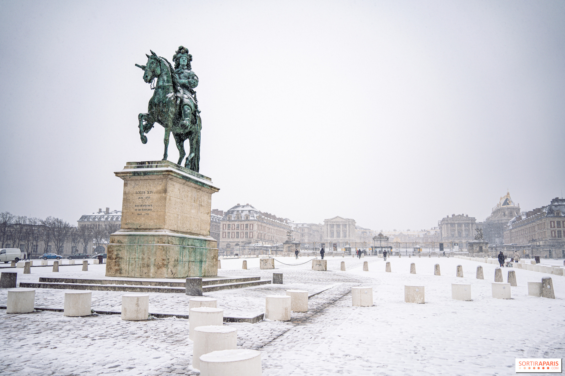
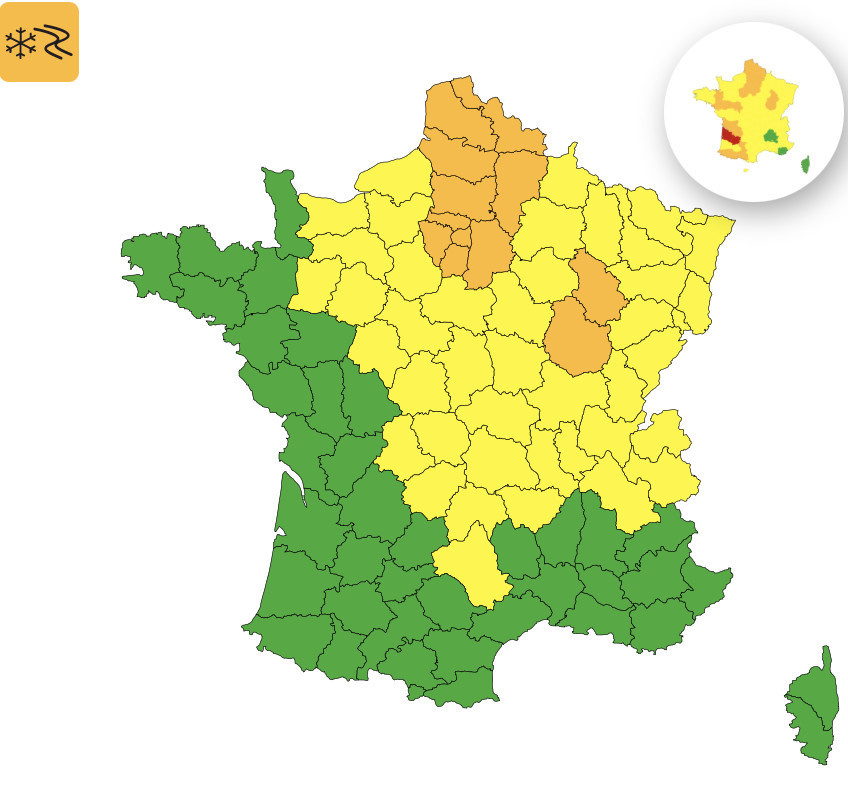
Snow is firmly established in Île-de-France this Sunday, February 15, 2026. All eight departments of the Île-de-France region have been placed under a orange alert for snow and ice since 8 a.m. this morning, according to Météo France. The first snowflakes began to fall at dawn over the Paris area, and this weather pattern is expected to continue into early afternoon.
The Île-de-France region is among the eleven departments in northern France under this orange alert. The other departments include Aisne, Ardennes, Aube, Marne, Nord, Oise, Pas-de-Calais, Somme, and Yonne, as detailed by La Chaîne Météo. In the greater Paris area, Seine-et-Marne (77) and Val-d'Oise (95) are especially affected by this warning. Snowfall is moving from west to east this morning, with rates reaching approximately 1 cm per hour. Overall, snowfall is expected to accumulate between 1 and 3 cm on the ground, with local pockets of up to 5 cm in certain parts of the Yvelines (78), according to the department's prefecture.
The only notable exception is Paris city limits. Meteo France reports that the brief duration of the weather event, combined with low intensities and relatively warm soils, is unlikely to produce lasting snow on the ground within the capital. This morning, temperatures are hovering between 0 and 2°C across the entire region. Flurries are swirling in the Parisian sky, but don’t expect a persistent blanket of snow if you're in Paris itself. However, surrounding departments like Essonne (91), Yvelines, and Seine-et-Marne feature a noticeably whiter landscape, especially on plateaus and hills where snow accumulation can reach 4 to 8 cm temporarily before the warm spell returns.
Good news — this snowstorm will be short-lived. The orange alert for Île-de-France is expected to remain in effect until 2 p.m. this Sunday. As the day progresses, milder temperatures will take over, turning the snowfall to rain and causing the snow on the ground to quickly melt. In the Val-d'Oise (95), local authorities describe this as a low-intensity event that should end by early afternoon. However, caution is advised for the risk of freezing rain during the warm-up, when rain freezes upon contact with the still-cold ground. This phenomenon can make roads especially hazardous.
This was the most frustrating aspect of the day. The Paris Police Prefecture activated Level 2 of the Snow and Ice Plan as early as Saturday evening. In practical terms, speed limits have been reduced by 20 km/h across all major roads in the region, and heavy trucks are prohibited from exceeding certain weight thresholds. On the aviation front, numerous flights have been cancelled at Roissy and Orly. The General Directorate of Civil Aviation (DGAC) has instructed airlines to cut their flight schedules by 30% at Roissy between 7 a.m. and 4 p.m., and by 20% at Orly between 6 a.m. and 2 p.m. If you're planning to fly today, make sure to check the status of your flight with your airline. Drivers are advised to limit their trips, and if travel is absolutely necessary, to equip their vehicle adequately, carry food supplies, and bring blankets. You can check Bison Futé for route planning information and Ile-de-France Mobilités for public transport updates.
In short, we are remaining cautious this Sunday morning on the Île-de-France roads. Non-essential trips are being avoided, and everyone is advised to wait things out comfortably at home. Météo France has forecast a sharp warm-up starting early next week. The eight Île-de-France departments affected—Paris (75), Hauts-de-Seine (92), Seine-Saint-Denis (93), Val-de-Marne (94), Essonne (91), Yvelines (78), Val-d'Oise (95), and Seine-et-Marne (77)—remain under orange alert until mid-afternoon. The government risk website reminds everyone of the key safety precautions to follow during snow and ice conditions.
Snow in Paris on Wednesday, February 18, 2026? Snow and ice warning issued across Île-de-France
Several departments in northern and eastern France are under a yellow alert for snow and ice on Wednesday, February 18, 2026. In Île-de-France, the Val-d’Oise and Seine-et-Marne are affected. Here’s a roundup of the current situation. [Read more]
Dates and Opening Time
On February 15, 2026
Location
Île-de-France
Recommended age
For all


 Snow in Paris on Wednesday, February 18, 2026? Snow and ice warning issued across Île-de-France