
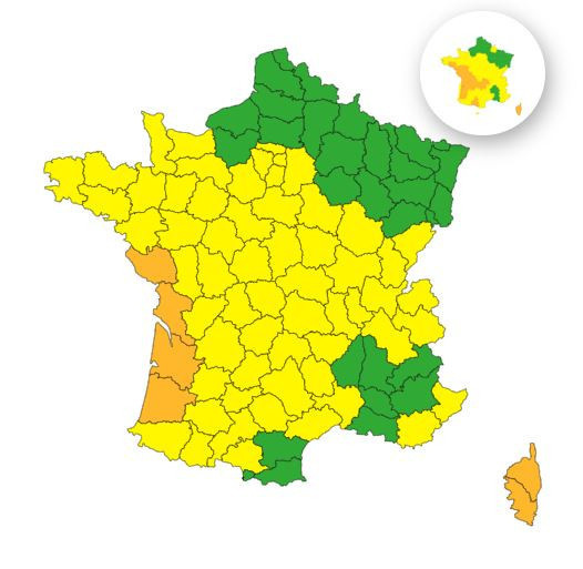
"The storm will hit the Atlantic coast Wednesday evening and then shift towards the Gulf of Lion and Corsica on Thursday," reports Météo France, noting that wind gusts are expected to reach "approximately 120 to 140 km/h near the ocean, 100 to 110 km/h inland in the Southwest, with locally stronger gusts during thunderstorms, and 130 to 150 km/h near the Mediterranean."
What can residents of Paris and the Île-de-France region expect in the coming hours? Due to Storm Nils, the Île-de-France area is placed on yellow wind alert starting Wednesday at 10 p.m. This alert will remain in effect throughout the night and much of Thursday, until around 4 p.m. According to the weather service, overnight winds could reach up to 80 km/h in the Yvelines, and possibly even 85 km/h in the northwest of Val-d’Oise. Gusts around 70 km/h could persist into Thursday morning across the entire Île-de-France region.
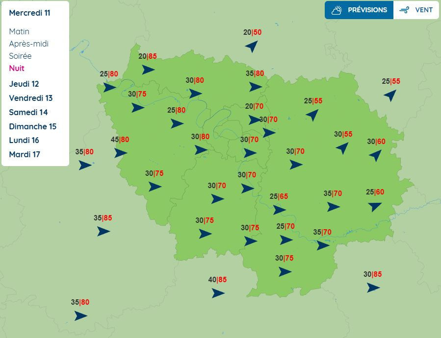
These winds will be accompanied by rainfall. Moderate rain is forecast for Wednesday evening across the region, with lighter showers expected on Thursday. Currently, Île-de-France is not under any flood or rain warning, but it's crucial to stay alert and check updates regularly on the meteorological services to remain informed.
Additionally, according to Météo Paris, the disturbance expected on Friday will be followed by "a significant drop in temperatures, likely leading to snowfall reaching the plains, especially in the northeast, Île-de-France, and the central region during Saturday."
Snowfall in Île-de-France: Paris and the region put on orange alert for snow and ice
The Île-de-France region has been placed on orange alert for snow and ice this Sunday, February 15, 2026. All eight departments in the area are affected by this snowfall, which is expected to last until early afternoon, with accumulations ranging from 1 to 5 centimeters in some places. [Read more]
Official website
meteofrance.com


 Snowfall in Île-de-France: Paris and the region put on orange alert for snow and ice