The weather in Paris and Île-de-France takes a sharp turn from Monday, November 16 to Sunday, November 22, 2026. The dry skies and light frosts of last weekend are over: Atlantic weather systems are moving through one after another, bringing rain almost every day and strengthening winds. Tuesday, November 17, is expected to bring the main risk, with strong winds forecast across the northern half of the country.
The entire region is affected, from Paris (75) to the Hauts-de-Seine (92), Seine-Saint-Denis (93) and Val-de-Marne (94), as well as the Yvelines (78), Essonne (91), Seine-et-Marne (77) and Val-d'Oise (95). Open areas in the outer suburbs will be most exposed to gusts.
The figures below are based on Météo-France for the start of the week and on Météo Paris’s 15-day forecast, updated this Sunday, November 15. Exactly how strong the wind will be on Tuesday remains the big unknown.
The high-pressure system that had brought us sunshine and dry, cold weather has shifted east over Europe. It is making way for a southwesterly flow laden with unsettled weather, fueled by a very powerful jet stream aloft, as Météo Paris’s analysis explains.
This corridor of high-altitude winds helps low-pressure systems deepen rapidly near the British Isles. In Île-de-France, that means a succession of rain fronts, temperatures that are fairly mild for the time of year, and sometimes strong gusts. It is like a weather conveyor belt, leaving only brief breaks between rainy spells.
Monday, November 16 gets off to a fairly calm start, with a few sunny spells in the morning, according to Météo-France. The skies then cloud over and light rain arrives in the afternoon, with around 6 millimeters expected. The southwesterly wind remains moderate.
The temperature is 8 degrees on waking and rises to 13 or 14 degrees in the afternoon, above seasonal norms. The evening is wetter and windier.
Tuesday, November 17 looks set to be the most unsettled day of the week. A low-pressure system deepening near the English Channel is expected to bring a marked strengthening of southwesterly winds, with gusts of 70 to 90 km/h possible in the Île-de-France region, according to Météo Paris. Forecast models point to winds of more than 100 km/h along the northwestern coast, but that scenario is less likely inland.
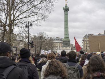
Showers will be frequent, with 6 to 10 millimeters expected and mild temperatures of 12 to 15 degrees. Tuesday is also a day of strikes and demonstrations in Paris, so it’s best to plan your journeys ahead. The Météo-France weather alert map, updated at 6 a.m. and 4 p.m., will indicate whether a wind alert has been issued.
Wednesday, November 18 remains windy, with gusts of up to 70 km/h, but showers will become less frequent. Expect temperatures of 10 degrees in the morning and 13 degrees in the afternoon.
On Thursday, November 19, the skies open up again, with frequent showers and 4 to 6 millimeters of rain. Another bout of strong winds is expected late in the day. Temperatures will range from 9 to 13 degrees.
Friday, November 20 continues in much the same vein, with unsettled skies and showers mainly in the afternoon. Temperatures peak at 12 degrees, after starting the day at 10 degrees.
Saturday, November 21 brings a welcome break, with drier, calmer weather. The air turns noticeably cooler, with temperatures of 6 degrees in the morning and 11 degrees in the afternoon. Météo Paris warns, however, that this lull could be short-lived.
Sunday, November 22 marks the return of an active weather system, bringing plenty of rain (10 to 15 millimeters) and westerly winds with gusts of up to 70 km/h. Temperatures will range from 6 to 13 degrees. A day to stay indoors.
Monday, November 23, could bring another dry lull, with temperatures between 8 and 12 degrees. The outlook remains much the same: forecasts suggest unsettled conditions over the Atlantic through the end of the month, with rainy and windy spells interrupted by short breaks. Models remain cautious about how intense these episodes will be.
With frequent rain, the soil will gradually become saturated. Any alerts can be followed on Météo-France’s weather alert service. As for air quality, the return of wind should disperse particulate matter effectively, as can be checked on Airparif.
With showers expected almost daily and strong winds forecast for Tuesday, we’ll stick to indoor outings. Museums and exhibitions in Paris or the latest movies are great options, as is a show or a play in the evening.
If the wind picks up as forecast, outdoor plans should be postponed, and people should steer clear of trees and parks, which the City of Paris often closes as a precaution when an alert is issued. Our guide to things to do in Paris this week brings together the best ideas for the moment, while our guide to the weekend in Paris and Île-de-France takes over for Saturday and Sunday.
As for getting around, the strike on Tuesday, November 17, and the closure of line 6 on Sunday are adding to the vagaries of the weather. This week’s disruptions and the metro, RER and train traffic update can help you plan ahead.
This page may contain AI-assisted elements, more information here.
Dates and Opening Time
From November 16, 2026 to November 22, 2026
Recommended age
For all