While the snowfall seems to be behind us, the west and north of France are now bracing for a powerful windstorm! Named "Goretti", this storm is expected to hit the country between Thursday evening and Friday morning. "This depression is characterized by explosive deepening and can be described as a meteorological bomb," warns La Chaîne Météo. According to the meteorological service, the strongest winds are forecasted along the Normandy coast, with gusts reaching 120 to 140 km/h. Inland, winds between 90 and 110 km/h are also expected.
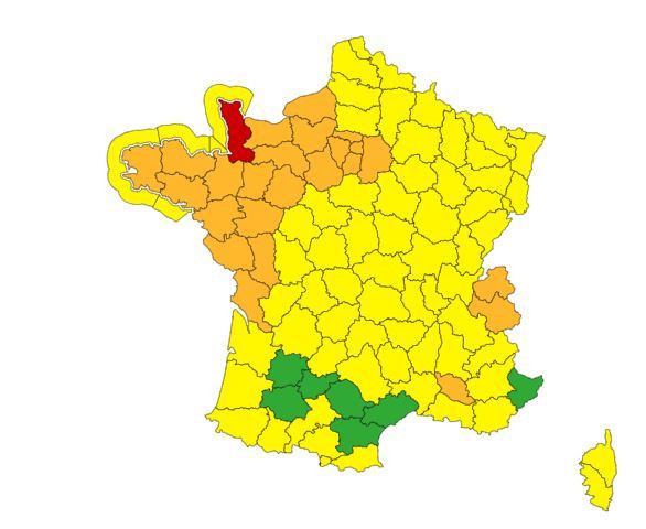
What’s the impact? The department of La Manche has been put on red alert for strong winds, while 27 other areas are under orange warning, including Seine-Maritime, Calvados, Eure, Mayenne, Sarthe, Oise, as well as Finistère, Loire-Atlantique, Vendée, Charente-Maritime, and Deux-Sèvres. "By late Thursday afternoon, the system associated with the 'Goretti' depression will reach Brittany and rapidly sweep across all regions in the northwest of the country during the evening and into the following night", warns Météo France. The agency specifies that in areas under orange alert, "gusts are expected to reach 100 to 120 km/h inland, with some reaching 130/140 km/h along the coast."
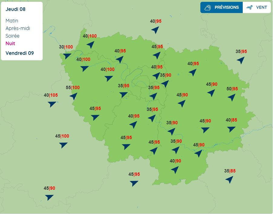
This stormy episode will also affect Île-de-France. "Regarding the Paris region, expected gusts are around 90 to 100 km/h for a prolonged event, with these gusts potentially lasting several hours," reports Météo France. On Thursday, January 8, 2026, Île-de-France is already under a yellow wind warning starting from 8 p.m. As the evening progresses into Thursday night and into Friday morning, the weather agency has increased its alert level. Paris and the remaining seven departments of Île-de-France (Hauts-de-Seine, Seine-Saint-Denis, Val-de-Marne, Seine-et-Marne, Yvelines, Essonne, and Val-d’Oise) are now under an orange alert for violent winds beginning at 10 p.m. and lasting until around 8 a.m. on Friday. After that, the alert level will downgrade back to yellow, lasting until 7 p.m.
According to Météo France, southwest and then southwesterly winds are expected to intensify Thursday evening, blowing very strongly throughout the night from Thursday to Friday and into early Friday morning. "Gusts will consistently reach 90 to 95 km/h over large areas, with local peaks of 100 km/h," warns the meteorological service.
As La Chaîne Météo reports, these anticipated strong winds in the Île-de-France region could cause falling branches or unstable trees, as well as disruptions to transportation, particularly Friday morning during rush hour." Motorists are advised to exercise caution, and public transit users are encouraged to check train schedules before heading to the station.
Storm Goretti in Île-de-France: Public Transport Likely to Experience Disruptions
Due to Storm Goretti, the Île-de-France region has been placed on orange alert for strong winds starting Thursday, January 8, at 10 p.m. What does this mean? Some tram, RER, and Transilien services are likely to face disruptions this Thursday evening and into Friday morning. [Read more]
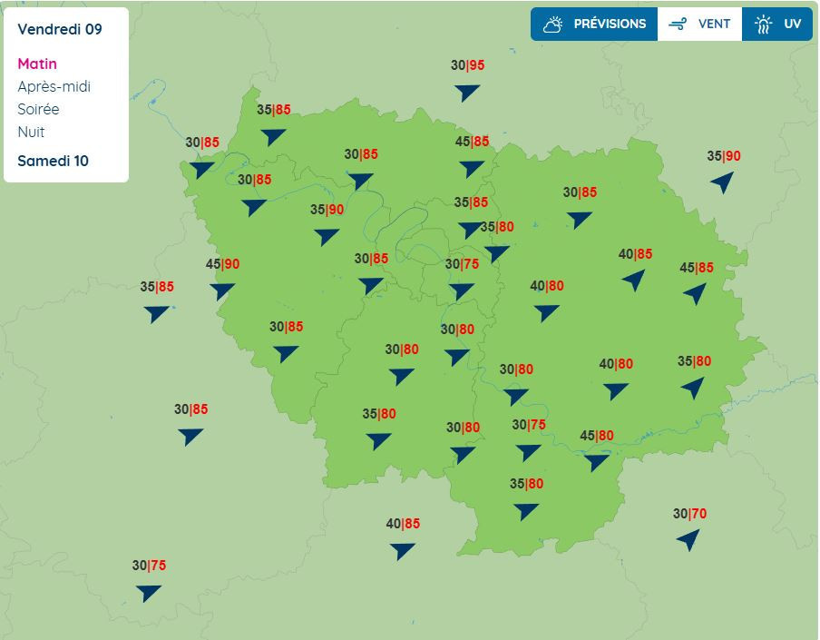
The western parts of Val-d'Oise, the west and north of Yvelines, as well as the southern areas of Essonne could experience the strongest gusts. These gusts are also likely to lead to the closure of parks, gardens, and cemeteries across Île-de-France.
While the heaviest gusts are forecasted to hit Île-de-France from Thursday night to Friday, winds will continue into the morning of Friday, January 9th, with speeds potentially reaching 85 km/h, and locally up to 90 km/h.
However, some uncertainty remains. It is therefore advisable to stay informed about the evolving forecasts and upcoming updates on the vigilance map. Be extremely cautious when traveling, and if possible, avoid using your car in departments affected by these intense gusts.
During severe weather events, Météo France recommends being vigilant for violent winds, which pose danger. Here are some precautionary tips:


 Storm Goretti in Île-de-France: Public Transport Likely to Experience Disruptions