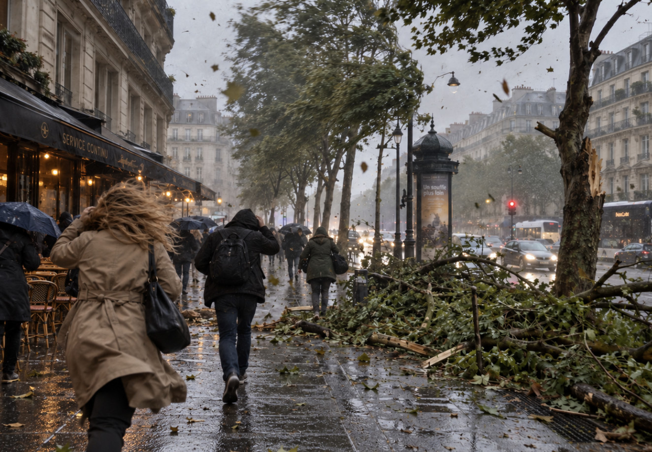
Paris and the entire Île-de-France region are under a yellow wind warning this Sunday, November 15, 2026. In its 6 a.m. bulletin, Météo-France lists all eight departments in the region: Paris (75), Seine-et-Marne (77), Yvelines (78), Essonne (91), Hauts-de-Seine (92), Seine-Saint-Denis (93), Val-de-Marne (94) and Val-d'Oise (95).
In Paris, gusts can reach 55 to 65 km/h, accompanied by showers. Nothing unusual for November, but enough to shake trees, outdoor terraces and two-wheelers for a few hours.
In the morning, southerly winds will remain light to moderate, with the first gusts of around 55 km/h expected around midday, according to Météo-France’s forecast for Paris.
The peak comes in the middle of the afternoon: the wind shifts to the south-southwest and picks up, with gusts reaching 65 km/h in some areas. It then eases in the evening.
As for the weather, it will remain very cloudy, with showers late in the morning followed by scattered showers in the afternoon. Temperatures will climb significantly after Saturday’s cold spell, reaching around 4°C in the morning and 14°C in the afternoon.
The weather will change completely in 24 hours. On Saturday, a high-pressure system brought clear skies and the first frost of autumn, as we reported in our weekend weather forecast. This Sunday, a weather front from the Atlantic is sweeping across the north of the country, bringing milder southwesterly winds but much more unsettled conditions.
Île-de-France is not alone: 63 departments are under a yellow weather alert this Sunday, mainly for wind, from Brittany to Grand Est via Centre. No departments are under an orange alert.
Yellow alerts warn of common weather phenomena that can be dangerous in some areas, Météo-France reminds us. A few simple precautions are all it takes to get through the day without any nasty surprises:
When the wind picks up, the City of Paris sometimes closes its parks, gardens and cemeteries as a precaution. Before heading out, check paris.fr or your local municipality’s website.
With gusty winds and showers, this Sunday is a good day for indoor outings: museums, exhibitions, cinemas or performance venues. Take your pick from this Sunday’s guide to events in Paris, our guide to things to do this weekend in Paris and the Île-de-France region or our ideas for rainy days.
As for transport, the RER D remains suspended between Gare du Nord and Gare de Lyon this Sunday, and Metro Line 12 is not running north of Jules Joffrin. For details, see our article on the metro and RER lines to avoid this weekend, and find today’s traffic updates in our live metro, RER and train updates.
Yes for Île-de-France, which will come off alert from Monday, according to Météo-France’s bulletin on Sunday morning. However, 34 departments remain under yellow alert, mostly in the west and east.
In Paris, Monday is forecast to be sunny in the morning, followed by light rain in the afternoon, with temperatures ranging from 8 to 14°C. The respite could be short-lived: Météo Paris has not ruled out further windstorms across the northern half of the country by November 22, though that scenario remains to be confirmed.
To follow developments hour by hour, the Météo-France weather alert map is updated at least twice a day, at 6 a.m. and 4 p.m. You can also check our Paris weather today and tomorrow every day.
Dates and Opening Time
On November 15, 2026
Official website
vigilance.meteofrance.fr