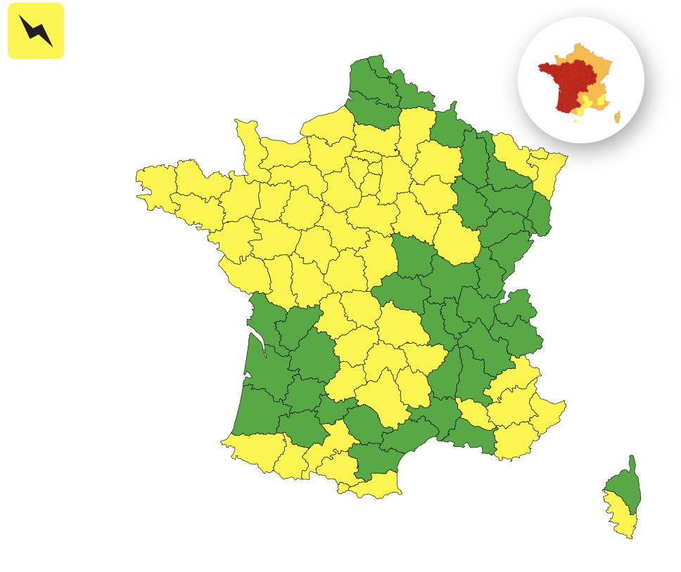
As the 2026 heat wave breaks records across France, with temperatures forecast to climb to as much as 40 °C in Paris this Monday, Météo-France has issued a yellow thunderstorm alert for the Île-de-France and about fifty other departments for this day, June 22, 2026. This is a situation to monitor closely late this afternoon and into the evening, especially in the eight departments in the Île-de-France region.
This exceptional heatwave context has no recent equivalent: Météo-France has never placed so many departments under red or orange heatwave warnings since 2004, the year the risk was added to France's weather vigilance system. In total, 54 departments are currently under red heatwave vigilance, and 35 are orange across the country.
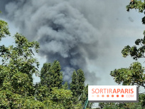
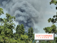
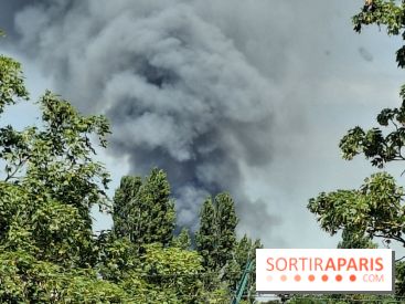
The storms forecast for this Monday, June 22 are no minor matter. According to Météo-France, they could come with hail, strong gusts of wind and heavy rainfall in a short period. A reminder from yesterday in the Hautes-Alpes illustrates the scale: a particularly violent storm triggered mudslides around Embrun, and it is this kind of episode that authorities fear this afternoon and evening in several regions.
The storm risk in Île-de-France sits within a convergence zone that runs from the Massif Central to Hauts-de-France, via the Centre. This corridor, a staple of heatwave periods, can spawn isolated yet exceptionally intense thunderstorm cells, capable of triggering localized floods, fallen trees, or disruptions to transport networks.
The physics of the atmosphere plays a central role here. Extreme heat fuels the formation of cumulonimbus, those massive thunderclouds that quickly surge higher as hot, humid air rises. The hotter the surface, the more energy is available to these systems, which can amplify their intensity. It is precisely this context that makes Monday’s yellow alert unusually serious, even if the overall warning level seems modest.
Beyond Île-de-France, the risque orageux touche également les Pyrénées, les Alpes et le relief corse also reaches the Pyrenees, the Alps and Corsica’s mountainous regions, areas that heat up during the day and release that energy as thunderstorms late in the afternoon. The situation therefore remains to be watched across a large part of the French territory this evening.
In the event of a storm, Météo-France urges people to avoid using their car unless absolutely necessary, steer clear of flooded roads, seek shelter in a sturdy building, and avoid wooded areas or riverbanks. In the city, basement and low-lying area floods should also be anticipated. Caution remains essential even under a yellow alert, as conditions can change rapidly.
To monitor the evolving situation in real time, regularly check the Météo-France vigilance map as well as the local bulletins issued throughout the day.
Dates and Opening Time
On June 22, 2026
Location
Paris and the Île-de-France region
Paris
75 Paris