The heat could linger longer than expected across France, particularly in the Île-de-France region (the departments 75, 77, 78, 91, 92, 93, 94 and 95) during the first half of September 2026. After a starting spell of unsettled, windy weather, sun and high temperatures are set to return by the end of the week, with a peak forecast for the weekend of September 5-6. What’s surprising is the latest models: instead of ending on Sunday, this heatwave could stretch into Tuesday, September 8, for parts of the country.
The mechanism is now well established. An anticyclonic ridge stretches from the Azores to France, drawing up a blistering air mass from northwestern Africa and the Iberian Peninsula. According to Météo-Paris, 35°C is already being exceeded on Friday, September 4, in many towns across the southern half of the country, with 37°C commonly in the Southwest and local peaks of 40°C, even 41°C in parts of the Aude on Saturday.
In Île-de-France, without hitting those extremes, the mercury is climbing noticeably as well. In Paris, highs are forecast to top out at 29°C on Friday, September 4, around 27°C on Saturday the 5th, then 31–32°C on Sunday the 6th, with a possible risk of late-afternoon thunderstorms. Mornings stay mild, between 17 and 19°C, delivering a fully summery feel for the back-to-school week.
That’s the main shift in the forecast. Initially seen as brief, the heat spike is turning into a much more stubborn episode. The hot air mass is expected to keep hovering over the south and east of France until Tuesday, September 8, 2026, with temperatures lingering at 30 to 35°C in those regions.
In the Île-de-France region, the picture is a little different. Oceanic air, guided by a low-pressure system over the British Isles, first sweeps into areas along the English Channel. In Paris, the heat holds on Monday, September 7 (around 30°C) before easing on Tuesday, September 8 (about 25°C), then returning to seasonal norms by Wednesday, September 9 (near 23°C) as an Atlantic disturbance moves in.
The question on everyone’s lips after a record-scorching summer in 2026: will it keep going? For the Île-de-France region, the answer appears to be no. Expected highs in the region (29 to 32°C in Paris) are well above the seasonal norm (about 23°C for a high in early September), but still far below what the south is experiencing.
Most notably, at the start of September, nights have lengthened nicely and the thermometer has fallen enough (17 to 19°C in the early hours in Paris) not to meet the criteria for a canicule, which requires higher minimums for several consecutive days. The day-by-day details can be found in our point météo francilien de la semaine.
This heatwave is accompanied by very little rainfall, worsening the drought that already affects the entire region and the country as a whole.
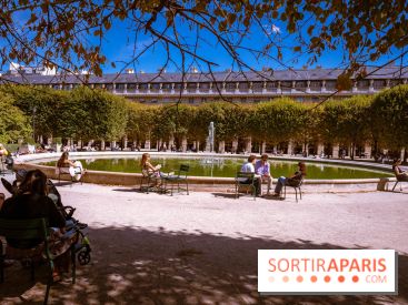
In Paris and Île-de-France, temperatures barely top 30°C, and the sky remains dry and sunny. Far from the heat peaks of the south, this spell feels more like a pleasant Indian summer at the start of the school year, to be savored while the sun lasts.
Take advantage before the upcoming cool spell expected around Wednesday, September 9: terraces, the banks of the Seine, major parks and gardens, strolls, or cultural outings—there are plenty of opportunities. Our weekend guide for Paris and Île-de-France already offers a solid glimpse of the program. To follow day-by-day updates, the most reliable option is to check Météo-France, updated daily.
Dates and Opening Time
From September 2, 2026 to September 8, 2026