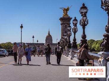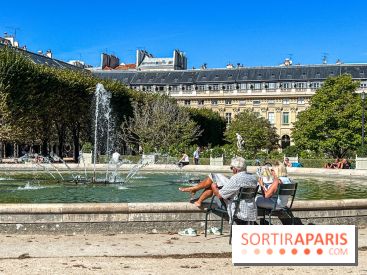
The orange heat-wave alert is being extended to Paris (75) and the seven other departments of Île-de-France this Thursday, July 9 and Friday, July 10, 2026. In its bulletin released this Thursday at 7:18 a.m., Météo-France keeps the entire region on alert: Seine-et-Marne (77), the Yvelines (78), the Essonne (91), the Hauts-de-Seine (92), the Seine-Saint-Denis (93), the Val-de-Marne (94) and the Val-d'Oise (95) remain under the same warning as the capital.
And the mercury is climbing at full speed. After readings of 34 to 36°C on Wednesday across the region (34.3°C at Paris-Montsouris, 34.8°C at Suresnes, 35.6°C at Saint-Maur), Météo-France is forecasting highs of 35 to 36°C for Thursday, then up to 37, even 38°C on Friday in Paris and the inner suburbs. We were warning you about this third heat wave with as much as 38°C expected in Paris: we’ve arrived at it, with the peak looming on Friday.
Nationwide, the heat is pushing further north and east, and an expansion of orange heat alerts to additional departments, especially in the Grand Est, is expected in the next bulletins. By Friday, 39–40°C will be reached or approached from Poitou-Charentes to the Pays de la Loire and the Centre-Val de Loire. A preview: on Wednesday, temperatures peaked at 41.5°C in Nîmes and 40.8°C in Montpellier and Perpignan.
In Paris, the night offered no relief: by 5 a.m. this Thursday, the Paris-Montsouris station was still at 23°C. This afternoon, highs reach 35 to 36°C. Friday morning, the lows stay between 20 and 24°C, before renewed spikes to 35-37°C, possibly 38°C, Friday afternoon. The following night looks just as oppressive, with lows of 21 to 24°C.
Same scenario in the Hauts-de-Seine, where Suresnes rose to 34.8°C on Wednesday. The mercury is forecast to hit 35–36°C Thursday afternoon, with Friday morning lows not dropping below 20–24°C. By Friday afternoon, highs are expected to soar to 35–37°C, with possible peaks around 38°C.
In Seine-Saint-Denis, the trend is the same: highs around 35–36°C expected Thursday afternoon, with overnight lows of 20–24°C into Friday morning, then 35–37°C, locally 38°C, Friday afternoon. A sequence of hot days and warm nights is increasingly weighing on the population.
In the Val-de-Marne, the Saint-Maur station logged the region’s highest reading on Wednesday, at 35.6°C. By Thursday afternoon, highs are expected to climb to 35–36°C, with overnight lows Friday dawn dipping to 20–24°C and another push toward 35–37°C, potentially 38°C, Friday afternoon.
In the Yvelines, the night stayed hot even in the areas that are usually cooler: 22.8°C at Le Pecq and 21.7°C at Toussus-le-Noble by 5 a.m. this Thursday. This afternoon, highs will reach 34 to 36°C. Friday morning, overnight lows are expected to range between 18 and 21°C, before the thermometer climbs to between 35 and 38°C on Friday afternoon.
Essonne braces for Thursday with highs of 34–36°C, after Wednesday’s 36.6°C recorded in Milly-la-Forêt. On Friday, morning lows will run from 19 to 23°C, before afternoon highs of 36–38°C, among the region’s highest.
The department remains under close watch due to the fire risk: its prefecture has banned fireworks and access to woods and forests until July 15, 2026. A move that jeopardizes the July 14 celebrations in every Essonne commune.
In Seine-et-Marne, the countryside enjoyed a touch of nocturnal coolness, with a low of 16°C recorded in Crouy-sur-Ourcq at 5 a.m., compared with 21°C in Lognes-Émerainville in the urbanized area. This Thursday, daytime highs reach 34 to 36°C, after Donnemarie recorded 35.6°C and Fontainebleau 35°C on Wednesday. On Friday, overnight lows range from 16 to 20°C, and then the highs climb to between 35 and 38°C.
The Val-d'Oise gets through once again a bit better: 33 to 35°C this Thursday afternoon, with the highest readings in urban areas, such as Le Bourget and Roissy, where it was still around 21°C at 5 a.m. this morning. On Friday, minimums will range from 19 to 23°C, followed by afternoon highs of 34 to 36°C—the coolest in the region.
Météo-France is clear in its bulletin: this severe and enduring heatwave will persist into the early part of next week across Île-de-France, and most likely until at least next weekend nationwide. Météo-France’s vigilance map, updated at 6 a.m. and 4 p.m. each day, remains the reference to watch, and we are monitoring its evolution closely.
Meanwhile, the prudent measures urged by the Ministry of Health remain in force: drink water regularly, close blinds during the day, air out at night, limit strenuous activity to the coolest hours, and check in on vulnerable people. To cool off, some Parisian parks stay open all night, the Bagatelle and Floral Park are free during orange vigilance, and the air‑conditioned museums such as the cooling hubs provide welcome, cool respite.
For day-by-day forecasts, check out our article on the week’s weather in Paris and Île-de-France, as well as our Paris heatwave guide with essential information, recommendations and tips.
Heatwave in Paris: when will the extreme heat in Île-de-France come to an end?
The end of the heatwave remains elusive in Paris and Île-de-France, where this third heat spell of 2026 is hanging on. Météo-France is poring over the models to pinpoint when temperatures will finally fall back to seasonal norms. We’re taking stock so you can see the light at the end of the tunnel. [Read more]
A fresh heatwave is battering Paris and the Île-de-France region. If you're looking for a cool spot these days, take advantage of the air-conditioned spaces at the capital's museums. [Read more]
The heatwave is back as July 2026 begins, after several brutal heatwaves already felt and endured earlier in May and June. In the face of these soaring temperatures, what measures are available for vulnerable groups, especially families and children? [Read more]
A third heatwave is settling over France and Île-de-France starting Monday, July 6, 2026, just days after the historic June heat. The thermometer climbs day after day in Paris, and the peak is expected by the end of the week, with readings typical of a full August. An orange alert has just been issued this Tuesday, July 7—here’s the situation. [Read more]
Did you know? When a heatwave warning is orange or red, the City of Paris activates the Heatwave Plan at level 3 and waives admission to Parc Floral de Paris and Parc de Bagatelle. Two green refuges where you can seek shade, see the cascades, and enjoy a little cool air. Here’s the full rundown. [Read more]
The June 2026 heatwave hit Île-de-France hard: Santé publique France recorded 619 additional deaths from June 22 to 28, amounting to a 60% excess mortality, a national record. And the mercury is already rising again in the region. [Read more]
This page may contain AI-assisted elements, more information here.
Dates and Opening Time
From July 9, 2026 to July 10, 2026
Location
Paris
75 Paris







 Heatwave in Paris: when will the extreme heat in Île-de-France come to an end?


 Heatwave in Paris: museums offering climate-controlled or refreshingly cool itineraries


 Heatwave in Paris: orange alert in effect, what options for families in Paris?


 Heatwave: the third heatwave begins, with temperatures expected to reach up to 38°C in Paris.


 Heatwave tip: Bagatelle Park and Parc Floral are free to visit during orange alert.


 Heatwave in Île-de-France: 60% increase in deaths, the hardest-hit region