Paris and parts of Île-de-France have been issued a yellow alert for storms and wind on Monday, February 16, 2026, by Météo-France. After last week's Nils storm, the weather remains volatile across the region, with frequent showers, the possibility of thunderstorms, and strong gusts expected throughout the day.
In practical terms, nine departments are under a yellow thunderstorm alert, including Paris, the Val-d'Oise (95), the Yvelines (78), Essonne (91), and Seine-et-Marne (77) in Île-de-France. The alert also covers the regions of Manche, Calvados, Seine-Maritime, and Eure in Normandy. Regarding wind, a total of 68 departments are on yellow alert across the country, including the Île-de-France region. Winds are expected to gust up to 50 to 60 km/h inland, reaching as high as 70 to 90 km/h near the Normandy coasts.
The day is expected to be quite gloomy, with overcast skies and frequent showers, sometimes accompanied by thunderclaps and hail. A northwest to west wind will blow steadily throughout the day, intensifying the feeling of cold. Temperatures will range between 5°C in the morning and 8 to 10°C in the afternoon across Paris and the inner suburbs, according to Météo-France's forecast for Paris. While these temperatures are relatively mild for February, the wind will make it feel much colder than the thermometer suggests.
Nationwide, the weather pattern is dominated by a disrupted northwest flow bringing heavy rainfall across mountainous regions, especially the Pyrenees and the Alps. Two departments, Gironde and Lot-et-Garonne, are even under red flood alert, while 14 others along the western coast remain on orange flood vigilance. You can track river levels and flooding updates on the Vigicrues website. Four departments in the Pyrenees are on orange rain-flood warning, with significant rainfall expected—around 30 to 50 mm, potentially reaching 70 to 100 mm in higher elevations. The situation is further compounded by a risk of snowpack melt.
In addition to thunderstorms and strong winds, Île-de-France has also been placed under yellow flood alert this Monday. Overall, 58 départements across France are affected by this warning, including the entire Île-de-France region. Recent days of heavy rainfall and saturated soils have caused water levels to rise in the region's rivers. The section of the Seine in Paris is under special monitoring by Vigicrues. Nationwide, the situation is far more serious, with Gironde and Lot-et-Garonne under red flood alerts, and 14 other departments along the western coast on orange alert.
The Seine is already flooding in Paris. After a weekend of heavy rain, the river’s water level has significantly risen, leading to the closure of some quay areas to traffic as of this Sunday. According to the City of Paris, the peak flood level is expected Tuesday, February 17, reaching an estimated height of four meters. While this remains a typical seasonal event, caution is still advised. Pedestrians and cyclists are restricted from accessing the affected riverbanks. It’s worth noting that upstream dams, like the recently tested barrier in Seine-et-Marne, play a crucial role in controlling water levels and preventing more severe flooding.
Nationally, the weather is dominated by a disrupted northwest airflow bringing heavy rain to the mountainous regions, particularly the Pyrenees and the Alps. Four departments in the Pyrenees are on orange alert for rain and flooding, with significant rainfall expected—around 30 to 50 mm, and potentially up to 70 to 100 mm in higher elevations. There is also a risk of snowmelt contributing to the situation.
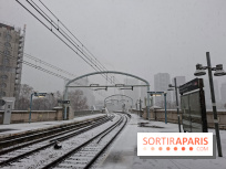
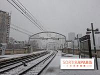
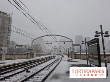
And it’s not over yet. While Monday serves as a transitional day between the weekend’s cold snap and the return of milder oceanic air, the week still has a surprise in store. A new risk of snow is expected overnight from Wednesday to Thursday, February 18-19, in Île-de-France. According to Meteo-Paris.com forecasts, a depression, diverted southward by the persistent cold air in the north, is expected to settle over France, bringing snowy precipitation along the Normandy-Île-de-France-Hauts-de-France axis. Remember, this past Sunday, February 15, Île-de-France was already under an orange snow-ice alert, with 1 to 5 centimeters of snow on the ground in some areas. Just as the chaos from the previous storm seems to be dying down, it looks like we might be heading back into it again.
For us residents of Île-de-France, there's no need to panic, but a bit of caution is advised. The yellow alert indicates that, although short-lived, there could be localized and intense weather phenomena that may cause disruptions, particularly on roads and in public transportation. We recommend checking the Île-de-France Mobilités website for real-time traffic updates. It's best to steer clear of standing under trees during gusts, and keep a firm grip on your umbrella—the wind tends to turn them inside out like crepes. Also, remember to secure any objects on balconies and terraces to prevent accidents.
To stay updated on the weather in Île-de-France throughout the day, the Météo-France vigilance map is the go-to resource, with regular updates. The website Meteo-Paris.com, curated by meteorologist Guillaume Séchet, also offers expert forecasts that are refreshed several times daily for Paris and the surrounding region. In short, this Monday continues the pattern of a quite stormy winter spell, and the week ahead may hold a few surprises, including a chance of snow on Wednesday evening in Île-de-France. We’re keeping an eye on the weather reports, avoiding falling branches, and dressing accordingly!